


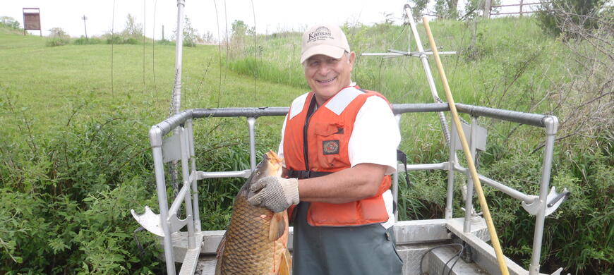
Brown State Fishing Lake Fishing Information


Counties:
GPS:
39.84509 -95.37681
Surface Acres:
62 acres
Maximum Depth:
13 feet
Normal Lake Level:
Full
8 miles east and 1/4 mile north of Hiawatha


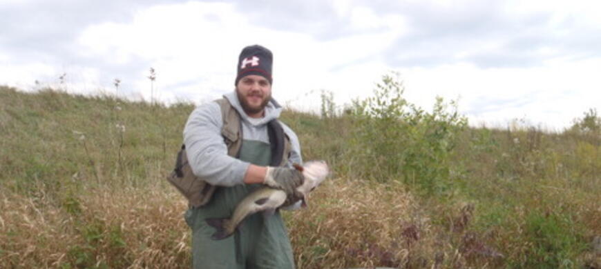
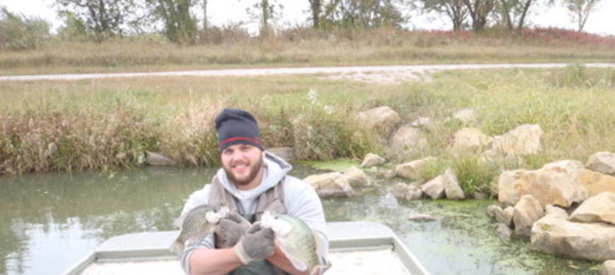
Brown State Fishing Lake Fishing Report - Updated: 07/20/2025
| Species | Rating | Size | Baits, Method & Location |
|---|---|---|---|
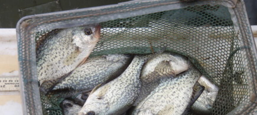
| Black Crappie | Fair | up to 1.0 lbs. | A few crappie can be found by jigging over shallower brush piles between jetties on the west side. |
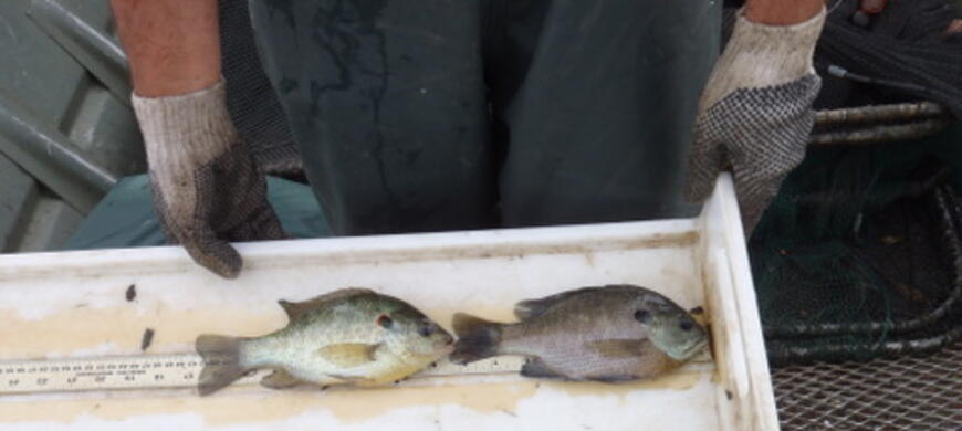
| Bluegill | Fair - Good | up to 0.3 lbs. | Bluegill may be caught using a chunk of worm and jigging it over brush piles. |
| Channel Catfish | Fair to Good | up to 5.5 lbs | Catfish can be caught from shore using cut bait, dough baits, or chicken livers. |
| Largemouth Bass | Fair to Good | up to 4.0 lbs. | Spinnerbaits or plastics working the shallows, along the face of the dam and the brush piles. |
| Redear Sunfish | Fair | up to 0.4 lbs. | Redear may be caught using a chunk of worm near shoreline structure. |
| General Comments | |||
| We are working to establish some native aquatic vegetation at Brown SFL. The fences in the water are to protect the plants until they spread naturally. Please do not disturb the plantings. If you have information that you would like to contribute to this fishing report, contact Nick Kramer at nick.kramer@ks.gov | |||
Creel Length/Limits
| Fishing Population | Creel Limit | Min Length Limit |
|---|---|---|
| Bluegill | ||
| Channel Catfish | 2 | 15 |
| Crappie | 20 | |
| Flathead Catfish | 5 | |
| Largemouth Bass | 2 | 18 |
| Redear Sunfish | ||
| Walleye | 5 | 15 |
* Largemouth, Smallmouth, Spotted Bass in Combination
** Striped Bass or Wiper in Combination
*** Walleye, Sauger or Saugeye in Combination
Fishing Forecast Information
View Fishing Forecast definitions
| Waterbody | Density | Preferred | Lunker | Big fish | Size | Bio rating |
|---|---|---|---|---|---|---|
| WIFA-Graham Co-Trexler Pond | 100.63 | 1.38 | 0.00 | 0.58 | Lake | Fair |
| Scott State Fishing Lake | 84.35 | 71.88 | 11.82 | 2.86 | Lake | Excellent |
| Lake Atwood | 82.25 | 0.00 | 0.00 | 0.45 | Lake | Fair |
| Carbondale City Lake-East | 58.88 | 10.00 | 0.50 | 0.90 | Lake | Excellent |
| Melvern River Pond | 46.60 | 23.80 | 1.40 | 1.86 | Lake | Good |
| Chanute City Lake | 42.50 | 3.50 | 0.50 | 1.33 | Lake | Good |
| Parsons City Lake | 41.38 | 18.63 | 5.50 | 2.25 | Lake | Good |
| Marion County Lake | 37.33 | 7.67 | 1.83 | 1.76 | Lake | Good |
| Eureka City Lake | 35.50 | 6.42 | 1.17 | 1.58 | Lake | Good |
| Howard-Polk Daniels Lake | 34.42 | 10.58 | 2.00 | 1.89 | Lake | Good |
| Ottawa State Fishing Lake | 33.59 | 1.65 | 0.29 | 1.45 | Lake | Good |
| Council Grove City Lake | 32.33 | 14.25 | 1.25 | 1.93 | Lake | Good |
| Sabetha City Lake | 30.25 | 15.75 | 3.00 | 1.55 | Lake | Good |
| Belleville-Rocky Pond | 28.38 | 13.00 | 3.50 | 1.43 | Lake | Good |
| Louisburg City Lake | 27.00 | 1.50 | 0.50 | 0.80 | Lake | Poor |
| Lebo City Lake | 25.38 | 12.38 | 2.50 | 1.11 | Lake | Good |
| Atchison City Lake #23 | 23.40 | 3.00 | 0.80 | 1.40 | Lake | Good |
| Neosho State Fishing Lake | 22.88 | 3.88 | 1.63 | 2.26 | Lake | Good |
| Mound City Lake | 21.75 | 4.50 | 0.50 | 1.29 | Lake | Good |
| Atchison State Fishing Lake | 21.29 | 4.43 | 0.86 | 1.54 | Lake | Good |
| Chase State Fishing Lake | 21.13 | 3.75 | 0.50 | 1.11 | Lake | Fair |
| Sterling City Lake | 21.00 | 7.33 | 0.00 | 0.67 | Lake | Good |
| Great Bend-Vets Park Lake | 21.00 | 6.00 | 0.67 | 0.96 | Lake | Good |
| Osage City Lake | 20.75 | 7.75 | 3.25 | 1.45 | Lake | Good |
| Hain State Fishing Lake | 19.75 | 19.00 | 4.75 | 1.24 | Lake | Good |
| Garnett-Cedar Creek Lake | 19.53 | 5.53 | 1.13 | 1.54 | Lake | Good |
| Garnett City Lake-North | 19.33 | 13.67 | 1.33 | 1.10 | Lake | Good |
| Jewell State Fishing Lake | 17.69 | 8.38 | 0.19 | 1.48 | Lake | Good |
| Douglas Co-Lonestar Lake | 17.13 | 4.88 | 1.50 | 2.27 | Lake | Good |
| Holton-Prairie Lake | 16.50 | 3.25 | 0.75 | 0.96 | Lake | Good |
| Anthony City Lake | 15.50 | 7.30 | 2.20 | 1.66 | Lake | Fair |
| Pratt County Lake | 15.44 | 1.89 | 0.00 | 0.76 | Lake | Fair |
| Moline New City Lake-North | 15.42 | 2.42 | 0.83 | 1.43 | Lake | Good |
| Douglas State Fishing Lake | 14.64 | 7.55 | 1.82 | 3.13 | Lake | Good |
| Winfield City Lake | 14.56 | 4.56 | 0.11 | 0.93 | Lake | Good |
| Miami State Fishing Lake | 14.20 | 1.80 | 0.90 | 2.60 | Lake | Good |
| Graham Co-Antelope Lake | 14.11 | 12.89 | 7.00 | 1.69 | Lake | Good |
| Brown State Fishing Lake | 13.86 | 2.14 | 0.14 | 1.10 | Lake | Good |
| Fort Scott-Gunn Park W Pond-#2 | 13.67 | 1.50 | 0.50 | 1.52 | Lake | Good |
| Centralia City Lake | 13.50 | 1.63 | 0.17 | 1.67 | Lake | Good |
| Ford State Fishing Lake | 13.25 | 9.50 | 8.50 | 1.93 | Lake | Good |
| Gridley City Lake | 12.83 | 11.83 | 2.00 | 1.44 | Lake | Good |
| Coldwater Lake | 12.82 | 3.27 | 0.27 | 1.16 | Lake | Fair |
| Thayer City Lake-New | 12.50 | 4.50 | 0.00 | 0.71 | Lake | Fair |
| Banner Creek Lake | 11.38 | 2.04 | 0.29 | 1.56 | Lake | Good |
| Montgomery State Fishing Lake | 11.38 | 0.13 | 0.13 | 1.72 | Lake | Good |
| Horsethief Reservoir | 10.71 | 3.07 | 0.00 | 0.84 | Lake | Fair |
| Paola City Lake-Lake Miola | 10.36 | 4.00 | 0.82 | 1.29 | Lake | Good |
| Herington City Lake-New | 9.92 | 5.58 | 2.67 | 1.39 | Lake | Good |
| Yates Center-South Owl Lake | 9.42 | 3.33 | 1.08 | 1.67 | Lake | Good |
| Washington State Fishing Lake | 9.10 | 2.00 | 0.20 | 2.05 | Lake | Good |
| Nebo State Fishing Lake | 9.00 | 7.00 | 2.83 | 2.03 | Lake | Good |
| Yates Center City Lake-New | 8.64 | 1.64 | 0.36 | 1.30 | Lake | Good |
| Garnett City Lake-South | 8.50 | 0.50 | 0.00 | 0.43 | Lake | Fair |
| Ellis City Lake | 8.50 | 4.38 | 2.50 | 1.93 | Lake | Poor |
| Johnson Co-Shawnee Mission Lake | 7.71 | 2.29 | 0.14 | 0.75 | Lake | Good |
| Moline Old City Lake-South | 7.50 | 2.00 | 0.25 | 1.92 | Lake | Good |
| Pleasanton West Lake | 7.50 | 2.25 | 0.50 | 1.23 | Lake | Good |
| Lake Olathe | 7.33 | 1.83 | 0.00 | 0.83 | Lake | Good |
| Lyon State Fishing Lake | 7.00 | 4.67 | 2.08 | 2.55 | Lake | Good |
| Sabetha-Pony Creek Lake | 6.58 | 5.42 | 2.17 | 1.85 | Lake | Good |
| Alma City Lake | 6.50 | 2.50 | 0.75 | 1.46 | Lake | Good |
| Osage State Fishing Lake | 5.63 | 0.88 | 0.25 | 0.92 | Lake | Fair |
| Woodson State Fishing Lake | 5.56 | 3.22 | 0.00 | 0.86 | Lake | Good |
| Barber State Fishing Lake | 5.15 | 2.46 | 0.62 | 1.11 | Lake | Fair |
| Olpe City Lake | 4.92 | 2.50 | 0.92 | 2.31 | Lake | Fair |
| Edna City Lake | 4.50 | 2.00 | 0.00 | 0.68 | Lake | Fair |
| Osawatomie City Lake | 4.50 | 3.00 | 1.00 | 0.95 | Lake | Poor |
| Pottawatomie State Fishing Lake #2 | 4.45 | 2.09 | 0.45 | 1.29 | Lake | Good |
| Wellington City Lake | 4.25 | 3.75 | 0.00 | 0.89 | Lake | Good |
| Mined Land Pit 44A | 4.25 | 2.00 | 0.00 | 0.69 | Lake | Fair |
| McPherson State Fishing Lake | 4.17 | 1.33 | 0.44 | 1.52 | Lake | Good |
| Middle Creek State Fishing Lake | 4.17 | 0.58 | 0.08 | 1.26 | Lake | Fair |
| Shawnee State Fishing Lake | 4.08 | 2.50 | 0.42 | 1.04 | Lake | Good |
| Bone Creek Lake | 3.88 | 0.50 | 0.00 | 0.74 | Lake | Good |
| Johnson Co-Kill Creek Park Lake | 3.83 | 1.50 | 0.33 | 1.77 | Lake | Fair |
| Jeffrey Energy Center-Make Up Lake | 3.83 | 0.67 | 0.08 | 0.90 | Lake | Fair |
| Cowley State Fishing Lake | 3.75 | 1.25 | 0.38 | 3.41 | Lake | Poor |
| Geary State Fishing Lake | 3.36 | 1.45 | 0.18 | 1.03 | Lake | Fair |
| Wilson State Fishing Lake | 3.17 | 1.67 | 0.25 | 1.59 | Lake | Good |
| Pottawatomie State Fishing Lake #1 | 3.17 | 0.50 | 0.00 | 0.78 | Lake | Fair |
| Spring Hill City Lake | 3.00 | 2.00 | 0.50 | 0.88 | Lake | Good |
| Lake Shawnee | 2.46 | 1.08 | 0.08 | 0.86 | Lake | Fair |
| Harvey County Lake-East | 2.43 | 2.43 | 1.86 | 1.88 | Lake | Fair |
| Harvey County Lake-West | 2.25 | 1.58 | 0.42 | 1.61 | Lake | Poor |
| Johnson Co-Lexington Park Lake | 2.17 | 1.17 | 0.17 | 0.96 | Lake | Fair |
| Jeffrey Energy Center-Auxiliary Lake | 2.13 | 1.00 | 0.63 | 1.50 | Lake | Fair |
| Severy City Lake | 2.00 | 0.50 | 0.00 | 0.57 | Lake | Poor |
| Kiowa State Fishing Lake | 1.88 | 0.63 | 0.25 | 0.97 | Lake | Fair |
| Horton-Mission Lake | 1.75 | 0.25 | 0.25 | 1.21 | Lake | Fair |
| Crawford State Fishing Lake | 1.75 | 1.13 | 0.00 | 0.75 | Lake | Good |
| Meade State Fishing Lake | 1.17 | 0.50 | 0.17 | 1.35 | Lake | Fair |
| Clark State Fishing Lake | 1.00 | 0.15 | 0.00 | 0.67 | Lake | Fair |
| Great Bend-Stone Park Lake | 1.00 | 0.56 | 0.33 | 1.30 | Lake | Good |
| Madison City Lake | 1.00 | 0.83 | 0.58 | 1.56 | Lake | Poor |
| Pleasanton East Lake | 1.00 | 0.57 | 0.14 | 0.80 | Lake | Good |
| Browning Oxbow | 0.75 | 0.50 | 0.00 | 0.90 | Lake | Poor |
| Butler State Fishing Lake | 0.75 | 0.25 | 0.00 | 0.76 | Lake | Poor |
| Lake Lenexa | 0.75 | 0.25 | 0.00 | 0.55 | Lake | Fair |
| Richmond City Lake | 0.75 | 0.50 | 0.00 | 0.75 | Lake | Fair |
| Wichita-Chisholm North Lake | 0.75 | 0.50 | 0.25 | 1.04 | Lake | Poor |
| Leavenworth State Fishing Lake | 0.67 | 0.50 | 0.17 | 1.13 | Lake | Good |
| Bourbon State Fishing Lake | 0.50 | 0.00 | 0.00 | 0.50 | Lake | Poor |
| Gardner City Lake | 0.38 | 0.25 | 0.00 | 0.77 | Lake | Fair |
| Kingman State Fishing Lake | 0.00 | 0.00 | 0.00 | 0.22 | Lake | Poor |
| Hodgeman State Fishing Lake | 0.00 | 0.00 | 0.00 | 0.13 | Lake | Poor |
| Jetmore City Lake | 0.00 | 0.00 | 0.00 | 0.08 | Lake | Poor |
| Waterbody | Density | Preferred | Lunker | 3 yr avg | Size | Rating |
|---|---|---|---|---|---|---|
| Plainville Lake | 92.25 | 2.50 | 0.00 | 0.47 | Lake | F |
| Rooks State Lake | 55.50 | 0.75 | 0.00 | 0.52 | Lake | F |
| Osawatomie City Lake | 50.50 | 13.50 | 0.00 | 0.42 | Lake | G |
| Severy City Lake | 48.50 | 1.67 | 0.00 | 0.52 | Lake | G |
| Lyon State Fishing Lake | 47.58 | 13.83 | 2.25 | 1.16 | Lake | G |
| Louisburg City Lake | 47.50 | 2.00 | 0.00 | 0.37 | Lake | G |
| Altamont City Lake-West | 43.00 | 0.00 | 0.00 | 0.33 | Lake | G |
| Scott State Fishing Lake | 40.59 | 4.88 | 0.00 | 0.56 | Lake | G |
| Douglas State Fishing Lake | 30.88 | 14.13 | 0.13 | 0.74 | Lake | G |
| Sterling City Lake | 28.56 | 0.11 | 0.00 | 0.37 | Lake | G |
| Moline Old City Lake-South | 24.50 | 4.75 | 1.00 | 0.91 | Lake | G |
| Douglas Co-Lonestar Lake | 20.88 | 1.00 | 0.00 | 0.46 | Lake | G |
| Garnett-Cedar Creek Lake | 19.81 | 0.13 | 0.00 | 0.36 | Lake | G |
| Eureka City Lake | 18.50 | 0.00 | 0.00 | 0.37 | Lake | G |
| Edna City Lake | 18.00 | 2.50 | 0.00 | 0.44 | Lake | F |
| WIFA-Graham Co-Trexler Pond | 17.60 | 0.20 | 0.00 | 0.51 | Lake | F |
| Cowley State Fishing Lake | 17.13 | 3.50 | 0.25 | 0.83 | Lake | G |
| Gardner City Lake | 17.00 | 0.67 | 0.00 | 0.43 | Lake | G |
| Lake Afton | 16.77 | 0.00 | 0.00 | 0.44 | Lake | F |
| Lake Atwood | 16.25 | 0.00 | 0.00 | 0.38 | Lake | F |
| Howard-Polk Daniels Lake | 14.92 | 0.33 | 0.00 | 0.56 | Lake | G |
| Melvern River Pond | 14.60 | 10.40 | 1.20 | 0.74 | Lake | G |
| Altamont City Lake-East | 14.00 | 0.00 | 0.00 | 0.42 | Lake | G |
| Jewell State Fishing Lake | 13.53 | 5.47 | 0.06 | 0.56 | Lake | G |
| Sabetha City Lake | 13.13 | 1.75 | 0.00 | 0.36 | Lake | G |
| Neosho State Fishing Lake | 12.33 | 2.75 | 0.00 | 0.57 | Lake | G |
| Sabetha-Pony Creek Lake | 12.14 | 3.00 | 0.00 | 0.57 | Lake | E |
| Garnett City Lake-North | 11.86 | 2.43 | 0.57 | 1.01 | Lake | G |
| Great Bend-Vets Park Lake | 11.44 | 0.00 | 0.00 | 0.25 | Lake | G |
| Belleville-Rocky Pond | 11.00 | 0.63 | 0.00 | 0.50 | Lake | F |
| Brown State Fishing Lake | 10.71 | 0.07 | 0.00 | 0.41 | Lake | F |
| Bone Creek Lake | 10.50 | 1.96 | 0.08 | 0.92 | Lake | E |
| Miami State Fishing Lake | 10.13 | 0.00 | 0.00 | 0.33 | Lake | G |
| Woodson State Fishing Lake | 9.90 | 3.10 | 0.00 | 0.57 | Lake | G |
| Mined Land Pit 45A | 9.75 | 1.75 | 0.00 | 0.48 | Lake | G |
| Washington State Fishing Lake | 9.73 | 0.09 | 0.00 | 0.52 | Lake | F |
| Olathe-Cedar Lake | 9.50 | 0.17 | 0.00 | 0.33 | Lake | F |
| Lake Olathe | 9.17 | 0.08 | 0.00 | 0.44 | Lake | G |
| Lake Shawnee | 8.93 | 0.53 | 0.00 | 0.54 | Lake | G |
| Chase State Fishing Lake | 8.88 | 0.00 | 0.00 | 0.42 | Lake | G |
| Marion County Lake | 8.83 | 1.75 | 0.00 | 0.48 | Lake | G |
| Atchison City Lake #23 | 8.67 | 0.33 | 0.00 | 0.52 | Lake | F |
| Fort Scott-Gunn Park W Pond-#2 | 8.50 | 0.50 | 0.00 | 0.46 | Lake | G |
| Pottawatomie Co Lake | 8.33 | 1.00 | 0.00 | 0.62 | Lake | G |
| Shawnee State Fishing Lake | 8.08 | 2.75 | 0.42 | 0.73 | Lake | G |
| Jetmore City Lake | 8.00 | 2.00 | 0.25 | 0.88 | Lake | G |
| Wichita-Chisholm North Lake | 7.75 | 0.00 | 0.00 | 0.41 | Lake | G |
| Montgomery State Fishing Lake | 7.63 | 1.88 | 0.00 | 0.41 | Lake | G |
| Wilson State Fishing Lake | 7.58 | 2.50 | 0.42 | 0.76 | Lake | G |
| Graham Co-Antelope Lake | 7.44 | 3.67 | 0.00 | 0.79 | Lake | G |
| Pottawatomie State Fishing Lake #1 | 7.42 | 0.67 | 0.00 | 0.46 | Lake | G |
| Leavenworth State Fishing Lake | 6.75 | 2.25 | 0.00 | 0.55 | Lake | G |
| Jewell City Lake-Emerson Lake | 6.75 | 0.00 | 0.00 | 0.39 | Lake | P |
| Gridley City Lake | 6.67 | 4.00 | 1.00 | 0.68 | Lake | G |
| McPherson State Fishing Lake | 6.56 | 0.00 | 0.00 | 0.32 | Lake | G |
| Pottawatomie State Fishing Lake #2 | 6.33 | 0.75 | 0.00 | 0.70 | Lake | F |
| Osage State Fishing Lake | 6.33 | 1.42 | 0.00 | 0.83 | Lake | G |
| Garnett City Lake-South | 6.00 | 0.00 | 0.00 | 0.28 | Lake | G |
| Paola City Lake-Lake Miola | 5.75 | 0.00 | 0.00 | 0.22 | Lake | G |
| Lake Lenexa | 5.25 | 0.88 | 0.00 | 0.42 | Lake | G |
| Centralia City Lake | 4.90 | 0.00 | 0.00 | 0.34 | Lake | F |
| Mound City Lake | 4.75 | 0.25 | 0.00 | 0.50 | Lake | F |
| Anthony City Lake | 4.73 | 0.00 | 0.00 | 0.32 | Lake | F |
| Great Bend-Stone Park Lake | 4.56 | 0.00 | 0.00 | 0.35 | Lake | G |
| Fort Scott City Lake | 4.44 | 0.25 | 0.00 | 0.57 | Lake | F |
| Harvey County Lake-East | 4.31 | 0.00 | 0.00 | 0.41 | Lake | F |
| Spring Hill City Lake | 4.00 | 0.00 | 0.00 | 0.19 | Lake | F |
| Jeffrey Energy Center-Make Up Lake | 3.92 | 0.00 | 0.00 | 0.39 | Lake | F |
| Wichita-KDOT W. Borrow Pit | 3.83 | 0.33 | 0.33 | 1.08 | Lake | F |
| Bourbon Co-Cedar Creek Reservoir | 3.75 | 0.50 | 0.00 | 0.44 | Lake | F |
| Carbondale City Lake-East | 3.63 | 0.00 | 0.00 | 0.33 | Lake | P |
| Parsons City Lake | 3.25 | 0.00 | 0.00 | 0.31 | Lake | F |
| Pleasanton West Lake | 3.17 | 0.00 | 0.00 | 0.25 | Lake | F |
| Pleasanton East Lake | 2.88 | 0.00 | 0.00 | 0.26 | Lake | F |
| Barber State Fishing Lake | 2.74 | 0.53 | 0.00 | 0.62 | Lake | F |
| Ottawa State Fishing Lake | 2.61 | 0.00 | 0.00 | 0.35 | Lake | F |
| Geary State Fishing Lake | 2.58 | 0.08 | 0.00 | 0.32 | Lake | F |
| Nebo State Fishing Lake | 2.50 | 0.00 | 0.00 | 0.22 | Lake | P |
| Bourbon State Fishing Lake | 2.38 | 0.63 | 0.00 | 0.44 | Lake | F |
| Banner Creek Lake | 2.00 | 0.06 | 0.00 | 0.34 | Lake | P |
| Alma City Lake | 2.00 | 0.00 | 0.00 | 0.22 | Lake | F |
| Ellis City Lake | 2.00 | 0.00 | 0.00 | 0.18 | Lake | P |
| Middle Creek State Fishing Lake | 1.92 | 0.00 | 0.00 | 0.23 | Lake | P |
| Council Grove City Lake | 1.88 | 0.00 | 0.00 | 0.33 | Lake | P |
| Critzer Lake | 1.75 | 0.00 | 0.00 | 0.19 | Lake | F |
| Logan City Lake | 1.75 | 0.00 | 0.00 | 0.19 | Lake | F |
| Crawford State Fishing Lake | 1.67 | 0.08 | 0.00 | 0.41 | Lake | F |
| Yates Center City Lake-New | 1.38 | 0.62 | 0.38 | 1.15 | Lake | G |
| Madison City Lake | 1.25 | 0.00 | 0.00 | 0.27 | Lake | F |
| Holton-Prairie Lake | 1.00 | 0.00 | 0.00 | 0.18 | Lake | P |
| Richmond City Lake | 1.00 | 0.00 | 0.00 | 0.18 | Lake | F |
| Lebo City Lake | 1.00 | 0.11 | 0.00 | 0.43 | Lake | F |
| Yates Center-South Owl Lake | 1.00 | 0.00 | 0.00 | 0.28 | Lake | F |
| Mined Land Pit 44A | 1.00 | 0.00 | 0.00 | 0.28 | Lake | F |
| Clark State Fishing Lake | 0.92 | 0.25 | 0.00 | 0.42 | Lake | F |
| Herington City Lake-New | 0.92 | 0.00 | 0.00 | 0.35 | Lake | P |
| Jeffrey Energy Center-Auxiliary Lake | 0.85 | 0.00 | 0.00 | 0.40 | Lake | P |
| Tuttle Creek River Pond | 0.75 | 0.00 | 0.00 | 0.24 | Lake | P |
| Horsethief Reservoir | 0.58 | 0.05 | 0.00 | 0.41 | Lake | P |
| Pleasanton West Lake | 0.50 | 0.00 | 0.00 | 0.20 | Lake | P |
| Coldwater Lake | 0.38 | 0.00 | 0.00 | 0.34 | Lake | P |
| Meade State Fishing Lake | 0.25 | 0.00 | 0.00 | 0.16 | Lake | P |
| Kiowa State Fishing Lake | 0.11 | 0.00 | 0.00 | 0.35 | Lake | P |
| Atchison State Fishing Lake | 0.00 | 0.00 | 0.00 | 0.09 | Lake | P |
| Browning Oxbow | 0.00 | 0.00 | 0.00 | 0.10 | Lake | P |
| Pratt County Lake | 0.00 | 0.00 | 0.00 | 0.09 | Lake | F |
| Moline New City Lake-North | 0.00 | 0.00 | 0.00 | 0.12 | Lake | P |
| Olpe City Lake | 0.00 | 0.00 | 0.00 | 0.15 | Lake | P |
| Osage City Lake | 0.00 | 0.00 | 0.00 | 0.11 | Lake | P |
| Mined Land Pit 20B | 0.00 | 0.00 | 0.00 | 0.12 | Lake | F |
| Harvey County Lake-West | 0.00 | 0.00 | 0.00 | 0.09 | Lake | P |
| Waterbody | Density | Preferred | Lunker | Big fish | Size | Bio rating |
|---|---|---|---|---|---|---|
| Pleasanton East Lake | 165.95 | 6.77 | 0.00 | 3.58 | Lake | Excellent |
| Sterling City Lake | 136.86 | 23.32 | 0.00 | 4.57 | Lake | Good |
| Wilson State Fishing Lake | 120.48 | 34.08 | 1.92 | 6.14 | Lake | Good |
| Pratt County Lake | 102.22 | 64.37 | 0.00 | 5.05 | Lake | Good |
| Atchison City Lake #23 | 97.35 | 56.37 | 2.65 | 5.66 | Lake | Excellent |
| McPherson State Fishing Lake | 95.24 | 57.82 | 3.31 | 5.65 | Lake | Good |
| Montgomery State Fishing Lake | 94.73 | 60.31 | 8.53 | 6.22 | Lake | Good |
| Osage City Lake | 94.00 | 38.00 | 4.00 | 7.16 | Lake | Good |
| Neosho State Fishing Lake | 91.80 | 44.70 | 4.20 | 5.89 | Lake | Excellent |
| Altamont City Lake-West | 90.00 | 72.00 | 12.00 | 6.33 | Lake | Good |
| Garnett City Lake-North | 85.73 | 22.30 | 0.72 | 4.91 | Lake | Good |
| Johnson Co-Lexington Park Lake | 81.05 | 9.15 | 0.00 | 2.59 | Lake | Good |
| Thayer City Lake-New | 78.00 | 32.00 | 0.00 | 2.55 | Lake | Good |
| Cowley State Fishing Lake | 77.65 | 44.47 | 0.71 | 4.69 | Lake | Good |
| Jewell State Fishing Lake | 72.62 | 11.79 | 4.14 | 5.71 | Lake | Good |
| Scott State Fishing Lake | 70.86 | 25.06 | 0.45 | 5.80 | Lake | Good |
| Barber State Fishing Lake | 70.13 | 16.77 | 0.13 | 5.22 | Lake | Good |
| Sabetha-Pony Creek Lake | 67.26 | 31.83 | 0.23 | 4.77 | Lake | Excellent |
| Butler State Fishing Lake | 66.00 | 37.50 | 1.50 | 6.38 | Lake | Good |
| Coldwater Lake | 62.71 | 25.11 | 0.00 | 4.10 | Lake | Fair |
| Graham Co-Antelope Lake | 62.54 | 17.75 | 0.00 | 3.60 | Lake | Good |
| Chanute City Lake | 62.00 | 41.00 | 1.00 | 4.75 | Lake | Good |
| Pottawatomie State Fishing Lake #1 | 61.95 | 2.92 | 0.46 | 4.75 | Lake | Good |
| Great Bend-Stone Park Lake | 61.19 | 7.46 | 0.00 | 2.63 | Lake | Good |
| Meade State Fishing Lake | 58.89 | 39.72 | 0.00 | 4.26 | Lake | Fair |
| Garnett City Lake-South | 58.70 | 25.68 | 0.65 | 4.81 | Lake | Good |
| Fort Scott-Gunn Park W Pond-#2 | 57.72 | 24.46 | 0.00 | 4.96 | Lake | Good |
| Geary State Fishing Lake | 57.67 | 32.00 | 0.33 | 5.67 | Lake | Good |
| Great Bend-Vets Park Lake | 57.20 | 40.63 | 1.33 | 6.11 | Lake | Good |
| WIFA-Saline Co-Audubon | 57.00 | 39.00 | 0.00 | 4.60 | Lake | Fair |
| Lake Olathe | 56.66 | 20.43 | 0.62 | 5.26 | Lake | Excellent |
| Crawford State Fishing Lake | 55.61 | 23.31 | 0.92 | 5.29 | Lake | Good |
| Gridley City Lake | 54.88 | 21.65 | 0.00 | 3.39 | Lake | Good |
| Lyon State Fishing Lake | 54.75 | 29.65 | 0.00 | 3.83 | Lake | Good |
| Edna City Lake | 54.00 | 3.00 | 3.00 | 4.89 | Lake | Fair |
| Shawnee State Fishing Lake | 52.10 | 1.58 | 0.32 | 5.01 | Lake | Good |
| Holton-Prairie Lake | 48.99 | 25.92 | 0.74 | 5.76 | Lake | Good |
| Richmond City Lake | 47.99 | 18.01 | 2.41 | 5.45 | Lake | Good |
| Melvern River Pond | 47.25 | 26.25 | 0.00 | 4.44 | Lake | Good |
| Washington State Fishing Lake | 47.00 | 27.67 | 0.33 | 4.84 | Lake | Good |
| Severy City Lake | 45.66 | 17.22 | 0.00 | 3.56 | Lake | Good |
| Thayer City Lake-Old | 45.00 | 24.00 | 1.50 | 5.12 | Lake | Good |
| Douglas State Fishing Lake | 44.82 | 2.82 | 0.35 | 6.46 | Lake | Good |
| Douglas Co-Lonestar Lake | 44.00 | 12.00 | 0.33 | 5.82 | Lake | Good |
| Bourbon State Fishing Lake | 43.72 | 5.49 | 0.25 | 3.91 | Lake | Good |
| Ford State Fishing Lake | 43.60 | 20.20 | 0.00 | 3.65 | Lake | Fair |
| WIFA-Graham Co-Trexler Pond | 42.99 | 14.34 | 0.00 | 5.22 | Lake | Good |
| Moline Old City Lake-South | 40.92 | 15.97 | 0.00 | 2.74 | Lake | Good |
| Fort Scott City Lake | 40.81 | 11.20 | 0.40 | 4.81 | Lake | Good |
| Howard-Polk Daniels Lake | 38.76 | 22.69 | 1.26 | 5.12 | Lake | Good |
| Kiowa State Fishing Lake | 37.82 | 26.09 | 0.00 | 3.25 | Lake | Fair |
| Pleasanton Old Lake | 37.81 | 25.15 | 4.00 | 7.11 | Lake | Good |
| Lake Shawnee | 36.50 | 11.25 | 0.50 | 6.45 | Lake | Good |
| Johnson Co-Kill Creek Park Lake | 36.47 | 8.82 | 1.76 | 4.87 | Lake | Excellent |
| Alma City Lake | 36.08 | 10.50 | 0.00 | 1.81 | Lake | Good |
| Leavenworth State Fishing Lake | 35.94 | 4.30 | 0.00 | 3.46 | Lake | Fair |
| Johnson Co-Shawnee Mission Lake | 34.80 | 11.27 | 0.98 | 5.59 | Lake | Fair |
| Garnett-Cedar Creek Lake | 34.67 | 12.06 | 1.23 | 6.08 | Lake | Good |
| Madison City Lake | 34.60 | 22.29 | 1.66 | 5.20 | Lake | Good |
| Altamont City Lake-East | 34.00 | 18.00 | 8.00 | 6.34 | Lake | Good |
| Carbondale City Lake-East | 32.50 | 12.50 | 0.00 | 3.68 | Lake | Good |
| Spring Hill City Lake | 31.34 | 18.93 | 1.18 | 5.28 | Lake | Good |
| Mined Land Pit 30F | 31.26 | 13.58 | 0.32 | 5.01 | Lake | Good |
| Gardner City Lake | 30.07 | 7.52 | 0.65 | 5.18 | Lake | Good |
| Yates Center-South Owl Lake | 29.63 | 12.52 | 0.00 | 4.43 | Lake | Fair |
| Osawatomie City Lake | 28.76 | 5.82 | 0.00 | 2.05 | Lake | Poor |
| Paola City Lake-Lake Miola | 28.48 | 13.31 | 0.62 | 5.20 | Lake | Good |
| Bone Creek Lake | 27.00 | 16.29 | 1.07 | 5.41 | Lake | Good |
| Pleasanton West Lake | 26.61 | 15.75 | 0.00 | 4.33 | Lake | Good |
| Yates Center City Lake-New | 26.55 | 14.10 | 0.89 | 4.96 | Lake | Fair |
| Woodson State Fishing Lake | 26.02 | 2.29 | 0.00 | 3.57 | Lake | Fair |
| Clark State Fishing Lake | 25.18 | 12.21 | 0.00 | 4.68 | Lake | Fair |
| Ottawa State Fishing Lake | 24.96 | 9.82 | 0.55 | 5.98 | Lake | Fair |
| Wichita-KDOT W. Borrow Pit | 24.84 | 11.76 | 0.00 | 4.94 | Lake | Fair |
| Marion County Lake | 24.67 | 6.83 | 0.00 | 4.28 | Lake | Good |
| Sherman Co-Smoky Hill Garden | 24.50 | 19.23 | 0.00 | 4.28 | Lake | Fair |
| Winfield City Lake | 23.83 | 11.42 | 0.50 | 7.01 | Lake | Fair |
| Osage State Fishing Lake | 23.68 | 9.16 | 0.32 | 5.51 | Lake | Good |
| Chase State Fishing Lake | 23.00 | 5.00 | 0.67 | 4.90 | Lake | Fair |
| Louisburg City Lake | 22.35 | 3.53 | 2.35 | 4.83 | Lake | Fair |
| Wichita-KDOT E. Borrow Pit | 22.35 | 10.00 | 0.59 | 5.64 | Lake | Fair |
| Nebo State Fishing Lake | 22.06 | 14.71 | 1.47 | 5.02 | Lake | Good |
| Pottawatomie Co Lake | 21.10 | 5.73 | 0.00 | 3.52 | Lake | Good |
| Mined Land Pit 20A | 21.00 | 17.00 | 2.00 | 4.71 | Lake | Good |
| Banner Creek Lake | 20.59 | 9.95 | 0.23 | 5.09 | Lake | Fair |
| Brown State Fishing Lake | 19.14 | 9.54 | 0.84 | 4.83 | Lake | Fair |
| Pottawatomie State Fishing Lake #2 | 19.12 | 2.41 | 0.35 | 4.67 | Lake | Fair |
| Kingman State Fishing Lake | 18.56 | 12.57 | 0.00 | 3.34 | Lake | Good |
| Atchison State Fishing Lake | 18.54 | 5.76 | 0.33 | 4.78 | Lake | Fair |
| Horton-Little Lake | 18.18 | 15.15 | 0.00 | 5.13 | Lake | Fair |
| Eureka City Lake | 17.63 | 4.66 | 0.33 | 5.83 | Lake | Good |
| Lake Atwood | 17.09 | 6.36 | 0.00 | 5.23 | Lake | Fair |
| Jewell City Lake-Emerson Lake | 17.00 | 10.33 | 0.00 | 3.81 | Lake | Fair |
| Ellis City Lake | 16.77 | 5.85 | 0.29 | 5.08 | Lake | Fair |
| Miami State Fishing Lake | 15.03 | 10.13 | 1.31 | 6.21 | Lake | Excellent |
| Lake Lenexa | 14.59 | 1.23 | 0.49 | 4.49 | Lake | Good |
| Belleville-Rocky Pond | 14.25 | 2.25 | 0.00 | 3.60 | Lake | Poor |
| Horton-Mission Lake | 14.00 | 10.06 | 0.74 | 5.20 | Lake | Good |
| Olpe City Lake | 12.61 | 6.30 | 0.00 | 3.69 | Lake | Poor |
| Mined Land Pit 26A | 11.86 | 4.86 | 0.00 | 2.89 | Lake | Good |
| Jeffrey Energy Center-Auxiliary Lake | 11.54 | 6.46 | 0.00 | 3.15 | Lake | Fair |
| Lebo City Lake | 11.06 | 3.37 | 0.00 | 2.89 | Lake | Fair |
| Harvey County Lake-West | 10.02 | 5.34 | 0.00 | 4.32 | Lake | Poor |
| Centralia City Lake | 9.67 | 7.67 | 1.00 | 5.99 | Lake | Poor |
| Council Grove City Lake | 9.00 | 2.67 | 0.00 | 2.84 | Lake | Fair |
| Wichita-Chisholm North Lake | 8.40 | 3.78 | 0.00 | 4.72 | Lake | Poor |
| Middle Creek State Fishing Lake | 8.24 | 5.00 | 0.29 | 3.72 | Lake | Poor |
| Horsethief Reservoir | 7.93 | 6.75 | 1.20 | 5.52 | Lake | Fair |
| Blue Mound City Lake | 7.91 | 0.00 | 0.00 | 1.10 | Lake | Fair |
| Harvey County Lake-East | 7.88 | 0.63 | 0.32 | 5.00 | Lake | Poor |
| Jeffrey Energy Center-Make Up Lake | 6.75 | 3.37 | 0.00 | 3.41 | Lake | Poor |
| Anthony City Lake | 6.61 | 4.54 | 0.47 | 6.47 | Lake | Fair |
| Lake Afton | 6.25 | 2.57 | 0.00 | 2.98 | Lake | Poor |
| Jetmore City Lake | 5.57 | 3.72 | 0.00 | 2.30 | Lake | Fair |
| Sabetha City Lake | 4.71 | 1.18 | 1.18 | 6.64 | Lake | Poor |
| WIFA-Mitchell Co-Campbell | 4.00 | 4.00 | 0.00 | 5.57 | Lake | Poor |
| Parsons City Lake | 3.60 | 3.00 | 0.00 | 2.66 | Lake | Poor |
| Moline New City Lake-North | 2.52 | 0.63 | 0.00 | 2.26 | Lake | Poor |
| BLACK CRAPPIE | (>8") | (>10") | (>12") | (lbs.) | Fishing Rating |
|---|---|---|---|---|---|
| LAKE | |||||
| WIFA - GRAHAM CO - TREXLER POND | 100.63 | 1.38 | 0.00 | 0.58 | F |
| LAKE ATWOOD | 82.25 | 0.00 | 0.00 | 0.45 | F |
| MELVERN RIVER POND | 28.40 | 16.40 | 0.00 | 0.97 | G |
| BELLEVILLE - ROCKY POND | 28.38 | 13.00 | 3.50 | 1.43 | G |
| STERLING CITY LAKE | 21.00 | 7.33 | 0.00 | 0.67 | G |
| JEWELL SFL | 17.69 | 8.38 | 0.19 | 1.48 | G |
| GRAHAM CO - ANTELOPE LAKE | 13.67 | 12.67 | 6.78 | 1.69 | G |
| GRIDLEY CITY LAKE | 12.83 | 11.83 | 2.00 | 1.44 | G |
| THAYER CITY LAKE - NEW | 11.50 | 3.50 | 0.00 | 0.69 | G |
| ATCHISON SFL | 10.57 | 0.57 | 0.14 | 0.88 | G |
| ATCHISON CITY LAKE #23 | 10.20 | 0.20 | 0.00 | 0.53 | G |
| NEOSHO SFL | 9.13 | 0.50 | 0.00 | 0.59 | G |
| DOUGLAS SFL | 9.09 | 4.45 | 1.00 | 3.13 | G |
| CENTRALIA CITY LAKE | 7.71 | 0.50 | 0.17 | 1.67 | G |
| SABETHA CITY LAKE | 7.25 | 3.50 | 0.25 | 1.06 | G |
| MIAMI SFL | 7.10 | 0.90 | 0.50 | 2.60 | G |
| SABETHA - PONY CREEK LAKE | 6.58 | 5.42 | 2.17 | 1.85 | G |
| DOUGLAS CO - LONESTAR LAKE | 6.00 | 1.50 | 0.63 | 2.27 | G |
| WOODSON SFL | 5.56 | 3.22 | 0.00 | 0.86 | G |
| ANTHONY CITY LAKE | 4.80 | 1.30 | 0.20 | 1.23 | F |
| LOUISBURG CITY LAKE | 4.50 | 0.00 | 0.00 | 0.37 | P |
| BARBER SFL | 3.92 | 1.92 | 0.54 | 1.11 | F |
| BONE CREEK LAKE | 3.88 | 0.50 | 0.00 | 0.74 | G |
| COWLEY SFL | 3.75 | 1.25 | 0.38 | 3.41 | P |
| MOLINE OLD CITY LAKE - S | 3.75 | 0.75 | 0.00 | 0.71 | G |
| YATES CENTER CITY LAKE - NEW | 3.45 | 0.27 | 0.00 | 0.62 | F |
| LYON SFL | 3.33 | 1.75 | 0.67 | 2.55 | G |
| PAOLA CITY LAKE - LAKE MIOLA | 3.27 | 0.64 | 0.36 | 1.29 | F |
| POTTAWATOMIE SFL #1 | 3.17 | 0.50 | 0.00 | 0.78 | F |
| BROWN SFL | 3.00 | 0.00 | 0.00 | 0.51 | F |
| EDNA CITY LAKE | 3.00 | 1.50 | 0.00 | 0.68 | F |
| HOWARD - POLK DANIELS LAKE | 2.92 | 1.00 | 0.17 | 1.06 | P |
| OSAGE SFL | 2.88 | 0.50 | 0.00 | 0.52 | F |
| OSAWATOMIE CITY LAKE | 2.50 | 1.50 | 1.00 | 0.95 | P |
| SHAWNEE SFL | 2.33 | 1.00 | 0.17 | 1.04 | F |
| HOLTON - PRAIRIE LAKE | 2.25 | 0.25 | 0.00 | 0.65 | P |
| JOHNSON CO - LEXINGTON PARK LAKE | 2.17 | 1.17 | 0.17 | 0.96 | F |
| ALMA CITY LAKE | 2.00 | 0.25 | 0.00 | 0.76 | F |
| CHANUTE CITY LAKE | 2.00 | 0.50 | 0.00 | 0.68 | F |
| LAKE SHAWNEE | 1.92 | 1.08 | 0.08 | 0.86 | F |
| WILSON SFL | 1.92 | 1.08 | 0.00 | 0.91 | F |
| LAKE OLATHE | 1.92 | 0.17 | 0.00 | 0.83 | G |
| HORSETHIEF | 1.86 | 0.14 | 0.00 | 0.63 | P |
| POTTAWATOMIE SFL #2 | 1.73 | 0.45 | 0.00 | 0.52 | F |
| SEVERY CITY LAKE | 1.50 | 0.17 | 0.00 | 0.44 | P |
| MONTGOMERY SFL | 1.50 | 0.00 | 0.00 | 0.39 | F |
| COUNCIL GROVE CITY LAKE | 1.50 | 0.83 | 0.25 | 1.93 | F |
| BANNER CREEK LAKE | 1.42 | 0.58 | 0.21 | 1.56 | F |
| GEARY SFL | 1.36 | 0.45 | 0.18 | 1.03 | F |
| JOHNSON CO - KILL CREEK PARK LAKE | 1.33 | 0.33 | 0.00 | 0.56 | F |
| GARNETT CITY LAKE - N | 1.33 | 1.00 | 0.00 | 0.79 | F |
| WINFIELD CITY LAKE | 0.89 | 0.11 | 0.00 | 0.72 | P |
| GREAT BEND - STONE PARK LAKE | 0.78 | 0.56 | 0.33 | 1.30 | F |
| PRATT CO LAKE | 0.78 | 0.00 | 0.00 | 0.42 | P |
| FORD SFL | 0.75 | 0.75 | 0.75 | 1.60 | P |
| LAKE LENEXA | 0.75 | 0.25 | 0.00 | 0.55 | F |
| HARVEY CO LAKE - E | 0.71 | 0.71 | 0.29 | 1.71 | P |
| LEAVENWORTH SFL | 0.67 | 0.50 | 0.17 | 1.13 | P |
| OTTAWA SFL | 0.59 | 0.00 | 0.00 | 0.38 | P |
| GARNETT - CEDAR CREEK LAKE | 0.53 | 0.13 | 0.00 | 0.57 | P |
| MIDDLE CREEK SFL | 0.50 | 0.00 | 0.00 | 0.34 | F |
| SPRING HILL CITY LAKE | 0.50 | 0.00 | 0.00 | 0.31 | F |
| LEBO CITY LAKE | 0.50 | 0.00 | 0.00 | 0.44 | P |
| MINED LAND PIT #44A | 0.50 | 0.25 | 0.00 | 0.55 | F |
| JOHNSON CO - SHAWNEE MISSION LAKE | 0.43 | 0.14 | 0.00 | 0.45 | F |
| PARSONS CITY LAKE | 0.38 | 0.00 | 0.00 | 0.30 | P |
| GARDNER CITY LAKE | 0.38 | 0.25 | 0.00 | 0.77 | F |
| CRAWFORD SFL | 0.38 | 0.25 | 0.00 | 0.55 | G |
| ELLIS CITY LAKE | 0.38 | 0.00 | 0.00 | 0.33 | P |
| GREAT BEND - VETS PARK LAKE | 0.33 | 0.33 | 0.33 | 0.88 | F |
| MARION CO LAKE | 0.33 | 0.17 | 0.08 | 1.76 | P |
| MCPHERSON SFL | 0.28 | 0.06 | 0.00 | 0.45 | F |
| BROWNING OXBOW | 0.25 | 0.25 | 0.00 | 0.75 | P |
| HAIN SFL | 0.25 | 0.25 | 0.00 | 0.85 | P |
| BUTLER SFL | 0.25 | 0.00 | 0.00 | 0.14 | P |
| YATES CENTER - S OWL LAKE | 0.25 | 0.00 | 0.00 | 0.48 | P |
| NEBO SFL | 0.17 | 0.17 | 0.17 | 1.92 | P |
| EUREKA CITY LAKE | 0.08 | 0.00 | 0.00 | 0.30 | P |
| JEFFREY EC - AUXILIARY LAKE | 0.08 | 0.04 | 0.00 | 0.80 | P |
| CLARK SFL | 0.08 | 0.08 | 0.00 | 0.67 | P |
| HORTON - MISSION LAKE | 0.00 | 0.00 | 0.00 | 0.20 | P |
| KINGMAN SFL | 0.00 | 0.00 | 0.00 | 0.22 | P |
| JETMORE CITY LAKE | 0.00 | 0.00 | 0.00 | 0.08 | P |
| KIOWA SFL | 0.00 | 0.00 | 0.00 | 0.05 | P |
| HARVEY CO LAKE - W | 0.00 | 0.00 | 0.00 | 0.12 | P |
| HERINGTON CITY LAKE - NEW | 0.00 | 0.00 | 0.00 | 0.19 | P |
| CHANNEL CATFISH | (>16") | (>24") | (>28") | (lbs.) | Fishing Rating |
|---|---|---|---|---|---|
| LAKE | |||||
| PLEASANTON W LAKE | 17.00 | 0.67 | 0.00 | 5.31 | G |
| PARSONS CITY LAKE | 14.63 | 1.13 | 0.38 | 14.76 | G |
| MOUND CITY LAKE | 9.33 | 3.17 | 0.67 | 11.34 | E |
| GARNETT - CEDAR CREEK LAKE | 8.13 | 0.50 | 0.13 | 11.10 | G |
| CLARK SFL | 7.86 | 0.32 | 0.09 | 10.24 | G |
| CRITZER LAKE | 7.25 | 1.25 | 0.25 | 10.10 | E |
| EUREKA CITY LAKE | 6.94 | 1.06 | 0.22 | 10.26 | G |
| FORT SCOTT CITY LAKE | 6.50 | 0.17 | 0.00 | 5.31 | E |
| MIAMI SFL | 5.89 | 0.17 | 0.00 | 6.82 | G |
| PLEASANTON OLD LAKE | 5.67 | 0.67 | 0.00 | 5.89 | G |
| WOODSON SFL | 5.67 | 0.58 | 0.00 | 8.03 | G |
| HORTON - MISSION LAKE | 5.50 | 0.50 | 0.17 | 8.38 | E |
| HARVEY CO LAKE - E | 5.13 | 0.38 | 0.00 | 8.30 | F |
| COUNCIL GROVE CITY LAKE | 4.87 | 0.33 | 0.00 | 7.02 | G |
| BOURBON SFL | 4.86 | 0.43 | 0.29 | 8.65 | G |
| MIDDLE CREEK SFL | 4.72 | 0.67 | 0.11 | 8.56 | E |
| COLDWATER LAKE | 4.67 | 0.00 | 0.00 | 3.15 | F |
| BUTLER SFL | 4.38 | 0.13 | 0.13 | 9.48 | F |
| CENTRALIA CITY LAKE | 4.29 | 0.96 | 0.21 | 9.87 | E |
| BANNER CREEK LAKE | 4.21 | 0.33 | 0.13 | 13.70 | G |
| DOUGLAS SFL | 4.19 | 0.25 | 0.00 | 7.44 | G |
| LAKE LENEXA | 4.17 | 0.17 | 0.00 | 7.69 | G |
| CARBONDALE CITY LAKE - E | 4.17 | 1.83 | 0.75 | 15.42 | E |
| OTTAWA SFL | 4.13 | 0.13 | 0.00 | 5.36 | G |
| HAIN SFL | 4.00 | 2.00 | 0.00 | 7.48 | F |
| CHASE SFL | 4.00 | 0.00 | 0.00 | 5.11 | F |
| WINFIELD CITY LAKE | 3.91 | 0.18 | 0.00 | 6.28 | G |
| SCOTT SFL | 3.90 | 0.05 | 0.00 | 6.99 | G |
| BELLEVILLE - ROCKY POND | 3.75 | 0.00 | 0.00 | 4.34 | G |
| PAOLA CITY LAKE - LAKE MIOLA | 3.72 | 0.50 | 0.00 | 8.76 | G |
| PLEASANTON E LAKE | 3.70 | 0.50 | 0.10 | 10.79 | G |
| NEBO SFL | 3.67 | 0.11 | 0.00 | 5.03 | G |
| MADISON CITY LAKE | 3.63 | 0.06 | 0.00 | 5.18 | G |
| LAKE OLATHE | 3.61 | 0.22 | 0.06 | 10.89 | E |
| HOWARD - POLK DANIELS LAKE | 3.50 | 0.83 | 0.08 | 8.32 | F |
| JEWELL SFL | 3.33 | 0.17 | 0.17 | 10.58 | G |
| OLPE CITY LAKE | 3.33 | 0.25 | 0.17 | 11.01 | G |
| GARNETT CITY LAKE - N | 3.25 | 0.25 | 0.25 | 9.12 | G |
| NEOSHO SFL | 3.25 | 0.00 | 0.00 | 4.14 | G |
| WASHINGTON SFL | 3.17 | 1.33 | 0.75 | 12.04 | E |
| LAKE SHAWNEE | 3.14 | 0.43 | 0.10 | 10.29 | G |
| JETMORE CITY LAKE | 3.00 | 0.75 | 0.00 | 6.01 | F |
| DOUGLAS CO - LONESTAR LAKE | 3.00 | 0.18 | 0.00 | 6.17 | G |
| GRIDLEY CITY LAKE | 3.00 | 0.67 | 0.17 | 7.17 | G |
| GARDNER CITY LAKE | 2.92 | 0.25 | 0.00 | 6.54 | E |
| HERINGTON CITY LAKE - NEW | 2.80 | 0.47 | 0.07 | 10.98 | F |
| GRAHAM CO - ANTELOPE LAKE | 2.67 | 0.33 | 0.00 | 4.93 | F |
| BONE CREEK LAKE | 2.63 | 1.13 | 0.25 | 16.81 | G |
| BROWN SFL | 2.60 | 0.40 | 0.00 | 6.97 | G |
| OSAGE CITY LAKE | 2.57 | 0.00 | 0.00 | 6.17 | G |
| WIFA - GRAHAM CO - TREXLER POND | 2.56 | 0.33 | 0.00 | 5.94 | F |
| WELLINGTON CITY LAKE | 2.40 | 1.00 | 0.40 | 9.54 | G |
| SABETHA - PONY CREEK LAKE | 2.39 | 0.78 | 0.50 | 18.87 | G |
| SPRING HILL CITY LAKE | 2.33 | 0.00 | 0.00 | 4.55 | G |
| ANTHONY CITY LAKE | 2.25 | 0.00 | 0.00 | 4.07 | F |
| MARION CO LAKE | 2.25 | 0.25 | 0.08 | 15.09 | G |
| LYON SFL | 2.22 | 0.61 | 0.50 | 23.96 | G |
| GEARY SFL | 2.17 | 0.42 | 0.00 | 8.57 | F |
| MELVERN RIVER POND | 2.14 | 0.57 | 0.00 | 6.85 | F |
| JEFFREY EC - AUXILIARY LAKE | 2.04 | 0.04 | 0.00 | 5.27 | G |
| HOLTON - PRAIRIE LAKE | 2.00 | 0.00 | 0.00 | 4.23 | F |
| SABETHA CITY LAKE | 2.00 | 0.25 | 0.00 | 5.28 | G |
| JOHNSON CO - KILL CREEK PARK LAKE | 2.00 | 0.17 | 0.00 | 7.20 | G |
| MONTGOMERY SFL | 1.92 | 0.00 | 0.00 | 4.38 | G |
| JOHNSON CO - SHAWNEE MISSION LAKE | 1.92 | 0.50 | 0.00 | 7.22 | G |
| COWLEY SFL | 1.88 | 0.25 | 0.00 | 5.62 | F |
| BROWNING OXBOW | 1.83 | 0.17 | 0.00 | 6.35 | F |
| PRATT CO LAKE | 1.80 | 0.50 | 0.10 | 8.33 | G |
| WILSON SFL | 1.72 | 0.22 | 0.00 | 6.17 | G |
| GREAT BEND - VETS PARK LAKE | 1.67 | 0.00 | 0.00 | 4.04 | G |
| LOUISBURG CITY LAKE | 1.67 | 0.33 | 0.00 | 6.78 | F |
| GARNETT CITY LAKE - S | 1.67 | 0.00 | 0.00 | 1.36 | F |
| THAYER CITY LAKE - NEW | 1.67 | 0.00 | 0.00 | 2.53 | G |
| ATCHISON SFL | 1.50 | 0.00 | 0.00 | 4.45 | F |
| JEWELL CITY LAKE - EMERSON LAKE | 1.50 | 0.00 | 0.00 | 3.52 | F |
| CHANUTE CITY LAKE | 1.50 | 0.00 | 0.00 | 4.72 | G |
| LAKE ATWOOD | 1.38 | 0.13 | 0.00 | 5.19 | F |
| OSAWATOMIE CITY LAKE | 1.33 | 0.00 | 0.00 | 4.14 | F |
| FORT SCOTT - GUNN PARK W POND - #2 | 1.22 | 0.00 | 0.00 | 3.28 | F |
| YATES CENTER CITY LAKE - NEW | 1.17 | 0.00 | 0.00 | 5.09 | G |
| ATCHISON CITY LAKE #23 | 1.14 | 0.14 | 0.00 | 5.31 | F |
| POTTAWATOMIE SFL #2 | 1.08 | 0.00 | 0.00 | 3.11 | G |
| HARVEY CO LAKE - W | 1.08 | 0.00 | 0.00 | 2.99 | P |
| LEAVENWORTH SFL | 1.06 | 0.11 | 0.06 | 27.44 | F |
| MCPHERSON SFL | 1.03 | 0.07 | 0.00 | 6.22 | G |
| FORD SFL | 1.00 | 0.00 | 0.00 | 4.00 | F |
| ALMA CITY LAKE | 1.00 | 0.33 | 0.33 | 7.69 | F |
| GREAT BEND - STONE PARK LAKE | 0.94 | 0.00 | 0.00 | 3.81 | G |
| BARBER SFL | 0.93 | 0.20 | 0.00 | 6.23 | G |
| LEBO CITY LAKE | 0.91 | 0.36 | 0.18 | 10.70 | G |
| JOHNSON CO - LEXINGTON PARK LAKE | 0.83 | 0.33 | 0.33 | 9.36 | F |
| SHAWNEE SFL | 0.83 | 0.06 | 0.00 | 5.01 | G |
| YATES CENTER - S OWL LAKE | 0.76 | 0.12 | 0.00 | 6.54 | G |
| ELLIS CITY LAKE | 0.71 | 0.00 | 0.00 | 3.77 | F |
| MINED LAND PIT #44A | 0.67 | 0.00 | 0.00 | 3.48 | G |
| THAYER CITY LAKE - OLD | 0.67 | 0.00 | 0.00 | 2.18 | G |
| WICHITA - KDOT W BORROW PIT | 0.67 | 0.00 | 0.00 | 2.64 | P |
| MOLINE NEW CITY LAKE - N | 0.61 | 0.22 | 0.22 | 11.09 | G |
| STERLING CITY LAKE | 0.58 | 0.25 | 0.17 | 9.80 | F |
| KIOWA SFL | 0.50 | 0.00 | 0.00 | 1.89 | F |
| MEADE SFL | 0.40 | 0.10 | 0.00 | 5.37 | F |
| HORSETHIEF | 0.35 | 0.00 | 0.00 | 3.02 | F |
| MOLINE OLD CITY LAKE - S | 0.33 | 0.00 | 0.00 | 2.43 | F |
| JEFFREY EC - MAKE UP LAKE | 0.33 | 0.06 | 0.00 | 5.13 | F |
| RICHMOND CITY LAKE | 0.33 | 0.00 | 0.00 | 1.81 | F |
| OSAGE SFL | 0.33 | 0.00 | 0.00 | 3.85 | F |
| SYRACUSE - SAM'S POND | 0.25 | 0.00 | 0.00 | 4.30 | F |
| WICHITA - CHISHOLM N LAKE | 0.17 | 0.00 | 0.00 | 3.99 | P |
| POTTAWATOMIE SFL #1 | 0.11 | 0.00 | 0.00 | 2.40 | P |
| CRAWFORD SFL | 0.08 | 0.00 | 0.00 | 2.53 | G |
| HODGEMAN SFL | 0.00 | 0.00 | 0.00 | 0.75 | P |
| EDNA CITY LAKE | 0.00 | 0.00 | 0.00 | 0.54 | F |
| LARGEMOUTH BASS | (>12") | (>15") | (>20") | (lbs.) | Fishing Rating |
|---|---|---|---|---|---|
| LAKE | |||||
| PLEASANTON E LAKE | 165.95 | 6.77 | 0.00 | 3.58 | G |
| STERLING CITY LAKE | 136.86 | 23.32 | 0.00 | 4.57 | G |
| WILSON SFL | 108.24 | 32.40 | 1.92 | 6.14 | G |
| PRATT CO LAKE | 101.90 | 64.16 | 0.00 | 5.05 | G |
| ATCHISON CITY LAKE #23 | 97.35 | 56.37 | 2.65 | 5.66 | E |
| MCPHERSON SFL | 95.24 | 57.82 | 3.31 | 5.65 | G |
| MONTGOMERY SFL | 94.73 | 60.31 | 8.53 | 6.22 | G |
| OSAGE CITY LAKE | 94.00 | 38.00 | 4.00 | 7.16 | E |
| NEOSHO SFL | 91.80 | 44.70 | 4.20 | 5.89 | E |
| ALTAMONT CITY LAKE - W | 90.00 | 72.00 | 12.00 | 6.33 | G |
| GARNETT CITY LAKE - N | 85.45 | 22.02 | 0.72 | 4.91 | G |
| JOHNSON CO - LEXINGTON PARK LAKE | 81.05 | 9.15 | 0.00 | 2.59 | G |
| THAYER CITY LAKE - NEW | 78.00 | 32.00 | 0.00 | 2.55 | G |
| COWLEY SFL | 77.65 | 44.47 | 0.71 | 4.69 | G |
| JEWELL SFL | 72.62 | 11.79 | 4.14 | 5.71 | G |
| SCOTT SFL | 70.86 | 25.06 | 0.45 | 5.80 | G |
| BARBER SFL | 70.13 | 16.77 | 0.13 | 5.22 | G |
| SABETHA - PONY CREEK LAKE | 67.26 | 31.83 | 0.23 | 4.77 | E |
| BUTLER SFL | 66.00 | 37.50 | 1.50 | 6.38 | G |
| COLDWATER LAKE | 62.71 | 25.11 | 0.00 | 4.10 | F |
| GRAHAM CO - ANTELOPE LAKE | 62.54 | 17.75 | 0.00 | 3.60 | G |
| CHANUTE CITY LAKE | 62.00 | 41.00 | 1.00 | 4.75 | G |
| POTTAWATOMIE SFL #1 | 61.95 | 2.92 | 0.46 | 4.75 | G |
| GREAT BEND - STONE PARK LAKE | 61.19 | 7.46 | 0.00 | 2.63 | G |
| MEADE SFL | 58.89 | 39.72 | 0.00 | 4.26 | F |
| GARNETT CITY LAKE - S | 58.70 | 25.68 | 0.65 | 4.81 | G |
| FORT SCOTT - GUNN PARK W POND - #2 | 57.72 | 24.46 | 0.00 | 4.96 | G |
| GREAT BEND - VETS PARK LAKE | 57.20 | 40.63 | 1.33 | 6.11 | G |
| WIFA - SALINE CO - AUDUBON | 57.00 | 39.00 | 0.00 | 4.60 | F |
| GEARY SFL | 57.00 | 31.33 | 0.33 | 5.67 | G |
| LAKE OLATHE | 56.66 | 20.43 | 0.62 | 5.26 | E |
| GRIDLEY CITY LAKE | 54.88 | 21.65 | 0.00 | 3.39 | G |
| LYON SFL | 54.75 | 29.65 | 0.00 | 3.83 | G |
| EDNA CITY LAKE | 54.00 | 3.00 | 3.00 | 4.89 | F |
| SHAWNEE SFL | 52.10 | 1.58 | 0.32 | 5.01 | G |
| HOLTON - PRAIRIE LAKE | 48.99 | 25.92 | 0.74 | 5.76 | G |
| RICHMOND CITY LAKE | 47.99 | 18.01 | 2.41 | 5.45 | G |
| MELVERN RIVER POND | 47.25 | 26.25 | 0.00 | 4.44 | G |
| WASHINGTON SFL | 47.00 | 27.67 | 0.33 | 4.84 | G |
| SEVERY CITY LAKE | 45.66 | 17.22 | 0.00 | 3.56 | G |
| CRAWFORD SFL | 45.23 | 21.92 | 0.92 | 5.29 | G |
| THAYER CITY LAKE - OLD | 45.00 | 24.00 | 1.50 | 5.12 | G |
| DOUGLAS SFL | 44.82 | 2.82 | 0.35 | 6.46 | G |
| DOUGLAS CO - LONESTAR LAKE | 44.00 | 12.00 | 0.33 | 5.82 | G |
| FORD SFL | 43.60 | 20.20 | 0.00 | 3.65 | F |
| WIFA - GRAHAM CO - TREXLER POND | 42.99 | 14.34 | 0.00 | 5.22 | G |
| MOLINE OLD CITY LAKE - S | 40.92 | 15.97 | 0.00 | 2.74 | G |
| KIOWA SFL | 37.82 | 26.09 | 0.00 | 3.25 | F |
| PLEASANTON OLD LAKE | 37.81 | 25.15 | 4.00 | 7.11 | G |
| FORT SCOTT CITY LAKE | 37.61 | 11.20 | 0.40 | 4.81 | G |
| HOWARD - POLK DANIELS LAKE | 37.50 | 22.06 | 1.26 | 5.12 | G |
| JOHNSON CO - KILL CREEK PARK LAKE | 36.47 | 8.82 | 1.76 | 4.87 | E |
| ALMA CITY LAKE | 36.08 | 10.50 | 0.00 | 1.81 | G |
| LEAVENWORTH SFL | 35.94 | 4.30 | 0.00 | 3.46 | F |
| LAKE SHAWNEE | 35.50 | 10.75 | 0.25 | 5.09 | G |
| JOHNSON CO - SHAWNEE MISSION LAKE | 34.80 | 11.27 | 0.98 | 5.59 | F |
| GARNETT - CEDAR CREEK LAKE | 34.67 | 12.06 | 1.23 | 6.08 | G |
| MADISON CITY LAKE | 34.60 | 22.29 | 1.66 | 5.20 | G |
| ALTAMONT CITY LAKE - E | 34.00 | 18.00 | 8.00 | 6.34 | G |
| CARBONDALE CITY LAKE - E | 32.50 | 12.50 | 0.00 | 3.68 | G |
| SPRING HILL CITY LAKE | 31.34 | 18.93 | 1.18 | 5.28 | G |
| MINED LAND PIT #30F | 31.26 | 13.58 | 0.32 | 5.01 | G |
| BOURBON SFL | 30.98 | 4.99 | 0.25 | 3.91 | G |
| GARDNER CITY LAKE | 30.07 | 7.52 | 0.65 | 5.18 | G |
| YATES CENTER - S OWL LAKE | 29.63 | 12.52 | 0.00 | 4.43 | F |
| OSAWATOMIE CITY LAKE | 28.76 | 5.82 | 0.00 | 2.05 | F |
| PAOLA CITY LAKE - LAKE MIOLA | 28.48 | 13.31 | 0.62 | 5.20 | G |
| BONE CREEK LAKE | 27.00 | 16.29 | 1.07 | 5.41 | G |
| PLEASANTON W LAKE | 26.61 | 15.75 | 0.00 | 4.33 | G |
| YATES CENTER CITY LAKE - NEW | 26.55 | 14.10 | 0.89 | 4.96 | F |
| WOODSON SFL | 26.02 | 2.29 | 0.00 | 3.57 | F |
| CLARK SFL | 25.18 | 12.21 | 0.00 | 4.68 | F |
| OTTAWA SFL | 24.96 | 9.82 | 0.55 | 5.98 | F |
| WICHITA - KDOT W BORROW PIT | 24.84 | 11.76 | 0.00 | 4.94 | F |
| SHERMAN CO - SMOKY HILL GARDEN | 24.50 | 19.23 | 0.00 | 4.28 | F |
| OSAGE SFL | 23.68 | 9.16 | 0.32 | 5.51 | F |
| LOUISBURG CITY LAKE | 22.35 | 3.53 | 2.35 | 4.83 | F |
| WICHITA - KDOT E BORROW PIT | 22.35 | 10.00 | 0.59 | 5.64 | F |
| NEBO SFL | 22.06 | 14.71 | 1.47 | 5.02 | G |
| MARION CO LAKE | 21.67 | 6.17 | 0.00 | 4.28 | G |
| POTTAWATOMIE CO LAKE | 21.10 | 5.73 | 0.00 | 3.52 | G |
| MINED LAND PIT #20A | 21.00 | 17.00 | 2.00 | 4.71 | G |
| CHASE SFL | 20.00 | 5.00 | 0.67 | 4.90 | F |
| BROWN SFL | 19.14 | 9.54 | 0.84 | 4.83 | F |
| BANNER CREEK LAKE | 19.00 | 9.28 | 0.23 | 5.09 | F |
| WINFIELD CITY LAKE | 18.58 | 9.17 | 0.50 | 7.01 | F |
| KINGMAN SFL | 18.56 | 12.57 | 0.00 | 3.34 | G |
| ATCHISON SFL | 18.54 | 5.76 | 0.33 | 4.78 | F |
| POTTAWATOMIE SFL #2 | 18.41 | 2.41 | 0.35 | 4.67 | F |
| HORTON - LITTLE LAKE | 18.18 | 15.15 | 0.00 | 5.13 | F |
| LAKE ATWOOD | 17.09 | 6.36 | 0.00 | 5.23 | F |
| JEWELL CITY LAKE - EMERSON LAKE | 17.00 | 10.33 | 0.00 | 3.81 | G |
| ELLIS CITY LAKE | 16.77 | 5.85 | 0.29 | 5.08 | F |
| EUREKA CITY LAKE | 16.63 | 4.66 | 0.33 | 5.83 | G |
| MIAMI SFL | 15.03 | 10.13 | 1.31 | 6.21 | E |
| LAKE LENEXA | 14.59 | 1.23 | 0.49 | 4.49 | G |
| BELLEVILLE - ROCKY POND | 14.25 | 2.25 | 0.00 | 3.60 | P |
| HORTON - MISSION LAKE | 14.00 | 10.06 | 0.74 | 5.20 | G |
| OLPE CITY LAKE | 12.61 | 6.30 | 0.00 | 3.69 | P |
| MINED LAND PIT #26A | 11.86 | 4.86 | 0.00 | 2.89 | G |
| LEBO CITY LAKE | 11.06 | 3.37 | 0.00 | 2.89 | F |
| HARVEY CO LAKE - W | 10.02 | 5.34 | 0.00 | 4.32 | P |
| CENTRALIA CITY LAKE | 9.67 | 7.67 | 1.00 | 5.99 | P |
| WICHITA - CHISHOLM N LAKE | 8.40 | 3.78 | 0.00 | 4.72 | P |
| MIDDLE CREEK SFL | 8.24 | 5.00 | 0.29 | 3.72 | P |
| HORSETHIEF | 7.93 | 6.75 | 1.20 | 5.52 | F |
| BLUE MOUND CITY LAKE | 7.91 | 0.00 | 0.00 | 1.10 | F |
| HARVEY CO LAKE - E | 7.88 | 0.63 | 0.32 | 5.00 | P |
| ANTHONY CITY LAKE | 6.61 | 4.54 | 0.47 | 6.47 | F |
| JEFFREY EC - MAKE UP LAKE | 6.37 | 3.00 | 0.00 | 3.41 | P |
| LAKE AFTON | 6.25 | 2.57 | 0.00 | 2.98 | P |
| COUNCIL GROVE CITY LAKE | 6.00 | 2.67 | 0.00 | 2.84 | F |
| JETMORE CITY LAKE | 5.57 | 3.72 | 0.00 | 2.30 | F |
| JEFFREY EC - AUXILIARY LAKE | 5.54 | 3.92 | 0.00 | 3.15 | F |
| SABETHA CITY LAKE | 4.71 | 1.18 | 1.18 | 6.64 | P |
| WIFA - MITCHELL CO - CAMPBELL | 4.00 | 4.00 | 0.00 | 5.57 | P |
| PARSONS CITY LAKE | 3.60 | 3.00 | 0.00 | 2.66 | P |
| MOLINE NEW CITY LAKE - N | 2.52 | 0.63 | 0.00 | 2.26 | P |
| BLUEGILL | (>6") | (>8") | (>10") | (lbs.) | Fishing Rating |
|---|---|---|---|---|---|
| LAKE | |||||
| GREAT BEND - VETS PARK LAKE | 64.17 | 0.00 | 0.00 | 0.25 | G |
| LOUISBURG CITY LAKE | 46.50 | 2.00 | 0.00 | 0.37 | P |
| SCOTT SFL | 28.24 | 0.59 | 0.00 | 0.47 | G |
| LAKE ATWOOD | 27.75 | 0.13 | 0.00 | 0.39 | G |
| GARNETT - CEDAR CREEK LAKE | 24.67 | 0.13 | 0.00 | 0.36 | G |
| HOWARD - POLK DANIELS LAKE | 19.83 | 0.00 | 0.00 | 0.26 | G |
| STERLING CITY LAKE | 19.44 | 0.00 | 0.00 | 0.32 | G |
| MARION CO LAKE | 17.67 | 2.08 | 0.00 | 0.51 | G |
| HAIN SFL | 15.50 | 2.50 | 0.00 | 0.61 | G |
| FORD SFL | 12.50 | 3.00 | 0.00 | 0.52 | G |
| WASHINGTON SFL | 12.50 | 0.10 | 0.00 | 0.32 | G |
| WIFA - GRAHAM CO - TREXLER POND | 12.13 | 0.25 | 0.00 | 0.70 | G |
| SABETHA - PONY CREEK LAKE | 10.92 | 5.17 | 0.00 | 0.62 | E |
| DOUGLAS CO - LONESTAR LAKE | 10.63 | 0.00 | 0.00 | 0.24 | G |
| HORSETHIEF | 10.14 | 0.07 | 0.00 | 0.41 | F |
| EUREKA CITY LAKE | 10.08 | 0.00 | 0.00 | 0.27 | G |
| PLEASANTON OLD LAKE | 9.50 | 0.00 | 0.00 | 0.20 | P |
| SEVERY CITY LAKE | 8.67 | 0.00 | 0.00 | 0.21 | G |
| MIAMI SFL | 8.30 | 0.00 | 0.00 | 0.33 | G |
| MELVERN RIVER POND | 8.20 | 1.80 | 0.00 | 0.52 | P |
| BANNER CREEK LAKE | 7.67 | 0.04 | 0.00 | 0.34 | G |
| LAKE SHAWNEE | 7.54 | 0.62 | 0.00 | 0.42 | G |
| WICHITA - CHISHOLM N LAKE | 7.38 | 0.13 | 0.00 | 0.40 | F |
| BUTLER SFL | 6.75 | 0.00 | 0.00 | 0.24 | P |
| WINFIELD CITY LAKE | 6.33 | 0.00 | 0.00 | 0.36 | F |
| LAKE OLATHE | 6.08 | 0.00 | 0.00 | 0.26 | F |
| JETMORE CITY LAKE | 6.00 | 1.25 | 0.00 | 0.54 | F |
| JEWELL SFL | 6.00 | 2.38 | 0.00 | 0.67 | G |
| PAOLA CITY LAKE - LAKE MIOLA | 5.73 | 0.00 | 0.00 | 0.22 | F |
| NEOSHO SFL | 5.13 | 0.13 | 0.00 | 0.33 | G |
| ATCHISON CITY LAKE #23 | 5.00 | 0.00 | 0.00 | 0.20 | G |
| SABETHA CITY LAKE | 5.00 | 0.00 | 0.00 | 0.34 | G |
| FORT SCOTT - GUNN PARK W POND - #2 | 5.00 | 0.17 | 0.00 | 0.44 | P |
| WILSON SFL | 4.75 | 0.00 | 0.00 | 0.40 | G |
| CHASE SFL | 4.63 | 0.13 | 0.00 | 0.31 | G |
| MOUND CITY LAKE | 4.50 | 0.00 | 0.00 | 0.24 | P |
| GREAT BEND - STONE PARK LAKE | 4.33 | 0.00 | 0.00 | 0.33 | G |
| GARNETT CITY LAKE - N | 4.33 | 0.00 | 0.00 | 0.34 | F |
| BROWN SFL | 4.29 | 0.00 | 0.00 | 0.34 | F |
| MADISON CITY LAKE | 4.25 | 0.17 | 0.00 | 0.47 | F |
| COWLEY SFL | 4.13 | 0.00 | 0.00 | 0.35 | G |
| GRAHAM CO - ANTELOPE LAKE | 4.11 | 1.67 | 0.00 | 0.57 | F |
| POTTAWATOMIE SFL #1 | 4.00 | 0.00 | 0.00 | 0.39 | G |
| GARNETT CITY LAKE - S | 4.00 | 0.00 | 0.00 | 0.28 | F |
| CHANUTE CITY LAKE | 3.50 | 0.00 | 0.00 | 0.20 | F |
| CLARK SFL | 3.46 | 0.00 | 0.00 | 0.28 | G |
| LEAVENWORTH SFL | 3.25 | 0.17 | 0.00 | 0.36 | F |
| PARSONS CITY LAKE | 3.25 | 0.00 | 0.00 | 0.31 | F |
| CARBONDALE CITY LAKE - E | 3.13 | 0.00 | 0.00 | 0.41 | F |
| DOUGLAS SFL | 3.00 | 0.18 | 0.00 | 0.37 | G |
| JEFFREY EC - MAKE UP LAKE | 3.00 | 0.08 | 0.00 | 0.38 | F |
| FORT SCOTT CITY LAKE | 3.00 | 0.00 | 0.00 | 0.28 | P |
| GARDNER CITY LAKE | 2.88 | 0.25 | 0.00 | 0.35 | F |
| JOHNSON CO - LEXINGTON PARK LAKE | 2.83 | 0.17 | 0.00 | 0.28 | G |
| COLDWATER LAKE | 2.73 | 0.09 | 0.00 | 0.51 | F |
| BONE CREEK LAKE | 2.56 | 0.19 | 0.00 | 0.38 | G |
| CRAWFORD SFL | 2.50 | 0.00 | 0.00 | 0.31 | G |
| JEWELL CITY LAKE - EMERSON LAKE | 2.25 | 0.00 | 0.00 | 0.35 | F |
| KINGMAN SFL | 2.20 | 0.00 | 0.00 | 0.26 | F |
| YATES CENTER - S OWL LAKE | 2.17 | 0.08 | 0.00 | 0.42 | F |
| MCPHERSON SFL | 2.06 | 0.00 | 0.00 | 0.20 | G |
| PLEASANTON W LAKE | 2.00 | 0.25 | 0.25 | 0.30 | F |
| CENTRALIA CITY LAKE | 1.96 | 0.00 | 0.00 | 0.31 | P |
| JOHNSON CO - KILL CREEK PARK LAKE | 1.83 | 0.17 | 0.00 | 0.48 | E |
| MOLINE OLD CITY LAKE - S | 1.50 | 0.25 | 0.00 | 0.44 | G |
| GRIDLEY CITY LAKE | 1.50 | 0.67 | 0.00 | 0.51 | F |
| MIDDLE CREEK SFL | 1.42 | 0.00 | 0.00 | 0.22 | F |
| COUNCIL GROVE CITY LAKE | 1.42 | 0.00 | 0.00 | 0.33 | F |
| LYON SFL | 1.33 | 0.42 | 0.00 | 0.62 | G |
| WOODSON SFL | 1.33 | 0.00 | 0.00 | 0.31 | F |
| POTTAWATOMIE SFL #2 | 1.27 | 0.00 | 0.00 | 0.26 | F |
| RICHMOND CITY LAKE | 1.25 | 0.00 | 0.00 | 0.22 | P |
| OTTAWA SFL | 1.18 | 0.00 | 0.00 | 0.38 | F |
| EDNA CITY LAKE | 1.00 | 0.00 | 0.00 | 0.21 | F |
| MONTGOMERY SFL | 1.00 | 0.00 | 0.00 | 0.26 | F |
| JOHNSON CO - SHAWNEE MISSION LAKE | 1.00 | 0.00 | 0.00 | 0.19 | P |
| OSAGE SFL | 1.00 | 0.00 | 0.00 | 0.25 | P |
| THAYER CITY LAKE - OLD | 1.00 | 0.00 | 0.00 | 0.19 | F |
| BELLEVILLE - ROCKY POND | 0.88 | 0.00 | 0.00 | 0.27 | P |
| GEARY SFL | 0.82 | 0.00 | 0.00 | 0.17 | F |
| SHERMAN CO - SMOKY HILL GARDEN | 0.67 | 0.00 | 0.00 | 0.17 | P |
| YATES CENTER CITY LAKE - NEW | 0.64 | 0.00 | 0.00 | 0.28 | F |
| JEFFREY EC - AUXILIARY LAKE | 0.63 | 0.00 | 0.00 | 0.30 | F |
| BARBER SFL | 0.62 | 0.00 | 0.00 | 0.26 | F |
| HOLTON - PRAIRIE LAKE | 0.50 | 0.00 | 0.00 | 0.19 | P |
| HORTON - MISSION LAKE | 0.50 | 0.00 | 0.00 | 0.14 | P |
| HODGEMAN SFL | 0.50 | 0.00 | 0.00 | 0.16 | P |
| LAKE LENEXA | 0.50 | 0.00 | 0.00 | 0.21 | G |
| BOURBON SFL | 0.50 | 0.00 | 0.00 | 0.16 | P |
| LEBO CITY LAKE | 0.50 | 0.00 | 0.00 | 0.19 | F |
| ELLIS CITY LAKE | 0.50 | 0.00 | 0.00 | 0.17 | F |
| HERINGTON CITY LAKE - NEW | 0.50 | 0.00 | 0.00 | 0.30 | F |
| ATCHISON SFL | 0.43 | 0.00 | 0.00 | 0.25 | P |
| SHAWNEE SFL | 0.42 | 0.08 | 0.00 | 0.37 | F |
| SYRACUSE - SAM'S POND | 0.33 | 0.00 | 0.00 | 0.29 | F |
| ANTHONY CITY LAKE | 0.30 | 0.00 | 0.00 | 0.20 | P |
| HARVEY CO LAKE - E | 0.29 | 0.00 | 0.00 | 0.15 | P |
| ALMA CITY LAKE | 0.25 | 0.00 | 0.00 | 0.29 | F |
| CRITZER LAKE | 0.25 | 0.00 | 0.00 | 0.17 | P |
| MINED LAND PIT #44A | 0.25 | 0.00 | 0.00 | 0.22 | F |
| PLEASANTON E LAKE | 0.14 | 0.00 | 0.00 | 0.22 | P |
| PRATT CO LAKE | 0.11 | 0.00 | 0.00 | 0.17 | P |
| MEADE SFL | 0.08 | 0.00 | 0.00 | 0.16 | P |
| MOLINE NEW CITY LAKE - N | 0.08 | 0.00 | 0.00 | 0.18 | P |
| NEBO SFL | 0.00 | 0.00 | 0.00 | 0.13 | P |
| KIOWA SFL | 0.00 | 0.00 | 0.00 | 0.11 | F |
| WELLINGTON CITY LAKE | 0.00 | 0.00 | 0.00 | 0.13 | F |
| OLPE CITY LAKE | 0.00 | 0.00 | 0.00 | 0.12 | P |
| SPRING HILL CITY LAKE | 0.00 | 0.00 | 0.00 | 0.13 | F |
| OSAWATOMIE CITY LAKE | 0.00 | 0.00 | 0.00 | 0.11 | F |
| OSAGE CITY LAKE | 0.00 | 0.00 | 0.00 | 0.11 | P |
| THAYER CITY LAKE - NEW | 0.00 | 0.00 | 0.00 | 0.06 | F |
| HARVEY CO LAKE - W | 0.00 | 0.00 | 0.00 | 0.09 | P |
| WHITE CRAPPIE | (>8") | (>10") | (>12") | (lbs.) | Fishing Rating |
|---|---|---|---|---|---|
| LAKE | |||||
| SCOTT SFL | 84.35 | 71.88 | 11.82 | 2.86 | E |
| CARBONDALE CITY LAKE - E | 58.88 | 10 | 0.5 | 0.9 | E |
| PARSONS CITY LAKE | 41 | 18.63 | 5.5 | 2.25 | G |
| CHANUTE CITY LAKE | 40.5 | 3 | 0.5 | 1.33 | G |
| MARION CO LAKE | 37 | 7.5 | 1.75 | 1.41 | G |
| EUREKA CITY LAKE | 35.42 | 6.42 | 1.17 | 1.58 | G |
| OTTAWA SFL | 33 | 1.65 | 0.29 | 1.45 | G |
| HOWARD - POLK DANIELS LAKE | 31.5 | 9.58 | 1.83 | 1.89 | G |
| COUNCIL GROVE CITY LAKE | 30.83 | 13.42 | 1 | 1.02 | G |
| LEBO CITY LAKE | 24.88 | 12.38 | 2.5 | 1.11 | G |
| SABETHA CITY LAKE | 23 | 12.25 | 2.75 | 1.55 | G |
| LOUISBURG CITY LAKE | 22.5 | 1.5 | 0.5 | 0.8 | P |
| MOUND CITY LAKE | 21.75 | 4.5 | 0.5 | 1.29 | G |
| CHASE SFL | 21.13 | 3.75 | 0.5 | 1.11 | F |
| OSAGE CITY LAKE | 20.75 | 7.75 | 3.25 | 1.45 | G |
| GREAT BEND - VETS PARK LAKE | 20.67 | 5.67 | 0.33 | 0.96 | G |
| HAIN SFL | 19.5 | 18.75 | 4.75 | 1.24 | G |
| GARNETT - CEDAR CREEK LAKE | 19 | 5.4 | 1.13 | 1.54 | G |
| MELVERN RIVER POND | 18.2 | 7.4 | 1.4 | 1.86 | G |
| GARNETT CITY LAKE - N | 18 | 12.67 | 1.33 | 1.1 | G |
| MOLINE NEW CITY LAKE - N | 15.42 | 2.42 | 0.83 | 1.43 | G |
| PRATT CO LAKE | 14.67 | 1.89 | 0 | 0.76 | F |
| HOLTON - PRAIRIE LAKE | 14.25 | 3 | 0.75 | 0.96 | G |
| NEOSHO SFL | 13.75 | 3.38 | 1.63 | 2.26 | G |
| WINFIELD CITY LAKE | 13.67 | 4.44 | 0.11 | 0.93 | G |
| FORT SCOTT - GUNN PARK W POND - #2 | 13.67 | 1.5 | 0.5 | 1.52 | G |
| ATCHISON CITY LAKE #23 | 13.2 | 2.8 | 0.8 | 1.4 | G |
| COLDWATER LAKE | 12.82 | 3.27 | 0.27 | 1.16 | G |
| FORD SFL | 12.5 | 8.75 | 7.75 | 1.93 | G |
| DOUGLAS CO - LONESTAR LAKE | 11.13 | 3.38 | 0.88 | 1.44 | G |
| BROWN SFL | 10.86 | 2.14 | 0.14 | 1.1 | G |
| ATCHISON SFL | 10.71 | 3.86 | 0.71 | 1.54 | G |
| ANTHONY CITY LAKE | 10.7 | 6 | 2 | 1.66 | F |
| BANNER CREEK LAKE | 9.96 | 1.46 | 0.08 | 0.87 | G |
| HERINGTON CITY LAKE - NEW | 9.92 | 5.58 | 2.67 | 1.39 | G |
| MONTGOMERY SFL | 9.88 | 0.13 | 0.13 | 1.72 | G |
| YATES CENTER - S OWL LAKE | 9.17 | 3.33 | 1.08 | 1.67 | G |
| WASHINGTON SFL | 9.1 | 2 | 0.2 | 2.05 | G |
| HORSETHIEF | 8.86 | 2.93 | 0 | 0.84 | P |
| NEBO SFL | 8.83 | 6.83 | 2.67 | 2.03 | G |
| GARNETT CITY LAKE - S | 8.5 | 0.5 | 0 | 0.43 | F |
| ELLIS CITY LAKE | 8.13 | 4.38 | 2.5 | 1.93 | P |
| PLEASANTON W LAKE | 7.5 | 2.25 | 0.5 | 1.23 | G |
| JOHNSON CO - SHAWNEE MISSION LAKE | 7.29 | 2.14 | 0.14 | 0.75 | G |
| MIAMI SFL | 7.1 | 0.9 | 0.4 | 2.38 | G |
| PAOLA CITY LAKE - LAKE MIOLA | 7.09 | 3.36 | 0.45 | 1.13 | G |
| CENTRALIA CITY LAKE | 5.79 | 1.13 | 0 | 0.84 | G |
| DOUGLAS SFL | 5.55 | 3.09 | 0.82 | 1.21 | F |
| LAKE OLATHE | 5.42 | 1.67 | 0 | 0.75 | G |
| YATES CENTER CITY LAKE - NEW | 5.18 | 1.36 | 0.36 | 1.3 | G |
| OLPE CITY LAKE | 4.92 | 2.5 | 0.92 | 2.31 | G |
| ALMA CITY LAKE | 4.5 | 2.25 | 0.75 | 1.46 | G |
| WELLINGTON CITY LAKE | 4.25 | 3.75 | 0 | 0.89 | G |
| MCPHERSON SFL | 3.89 | 1.28 | 0.44 | 1.52 | G |
| JEFFREY EC - MAKE UP LAKE | 3.83 | 0.67 | 0.08 | 0.9 | F |
| MOLINE OLD CITY LAKE - S | 3.75 | 1.25 | 0.25 | 1.92 | G |
| MINED LAND PIT #44A | 3.75 | 1.75 | 0 | 0.69 | F |
| LYON SFL | 3.67 | 2.92 | 1.42 | 1.7 | G |
| MIDDLE CREEK SFL | 3.67 | 0.58 | 0.08 | 1.26 | F |
| OSAGE SFL | 2.75 | 0.38 | 0.25 | 0.92 | F |
| POTTAWATOMIE SFL #2 | 2.73 | 1.64 | 0.45 | 1.29 | F |
| JOHNSON CO - KILL CREEK PARK LAKE | 2.5 | 1.17 | 0.33 | 1.77 | F |
| SPRING HILL CITY LAKE | 2.5 | 2 | 0.5 | 0.88 | G |
| HARVEY CO LAKE - W | 2.25 | 1.58 | 0.42 | 1.61 | P |
| JEFFREY EC - AUXILIARY LAKE | 2.04 | 0.96 | 0.63 | 1.5 | F |
| OSAWATOMIE CITY LAKE | 2 | 1.5 | 0 | 0.69 | P |
| GEARY SFL | 2 | 1 | 0 | 0.93 | P |
| KIOWA SFL | 1.88 | 0.63 | 0.25 | 0.97 | F |
| HORTON - MISSION LAKE | 1.75 | 0.25 | 0.25 | 1.21 | F |
| SHAWNEE SFL | 1.75 | 1.5 | 0.25 | 0.96 | F |
| HARVEY CO LAKE - E | 1.71 | 1.71 | 1.57 | 1.88 | F |
| EDNA CITY LAKE | 1.5 | 0.5 | 0 | 0.61 | F |
| CRAWFORD SFL | 1.38 | 0.88 | 0 | 0.75 | G |
| WILSON SFL | 1.25 | 0.58 | 0.25 | 1.59 | G |
| BARBER SFL | 1.23 | 0.54 | 0.08 | 1.01 | F |
| MEADE SFL | 1.17 | 0.5 | 0.17 | 1.35 | F |
| MADISON CITY LAKE | 1 | 0.83 | 0.58 | 1.56 | P |
| PLEASANTON E LAKE | 1 | 0.57 | 0.14 | 0.8 | G |
| THAYER CITY LAKE - NEW | 1 | 1 | 0 | 0.71 | F |
| CLARK SFL | 0.92 | 0.08 | 0 | 0.5 | P |
| RICHMOND CITY LAKE | 0.75 | 0.5 | 0 | 0.75 | P |
| WICHITA - CHISHOLM N LAKE | 0.75 | 0.5 | 0.25 | 1.04 | P |
| LAKE SHAWNEE | 0.54 | 0 | 0 | 0.4 | F |
| BROWNING OXBOW | 0.5 | 0.25 | 0 | 0.9 | P |
| BUTLER SFL | 0.5 | 0.25 | 0 | 0.76 | P |
| SEVERY CITY LAKE | 0.5 | 0.33 | 0 | 0.57 | P |
| BOURBON SFL | 0.5 | 0 | 0 | 0.5 | F |
| GRAHAM CO - ANTELOPE LAKE | 0.44 | 0.22 | 0.22 | 1.11 | P |
| GREAT BEND - STONE PARK LAKE | 0.22 | 0 | 0 | 0.41 | G |
| HODGEMAN SFL | 0 | 0 | 0 | 0.13 | P |
| JETMORE CITY LAKE | 0 | 0 | 0 | 0.08 | P |
Map Information